
Rašica Loop: Tower Views and a Family-Friendly Descent
Ljubljana & Central
Where to base yourself
Search places to stay near here and book directly on Booking.com.
Find a place to stayRašica Loop: Tower Views and a Family-Friendly Descent
Quick Overview – Rašica Loop
A short, well-marked loop just north of Ljubljana to a stone lookout tower with a genuinely wide view — Kamnik-Savinja peaks on one side, the Sava plain and Posavje hills on the other. Steep enough up, gentle enough down that it works as a real first hike for kids.
Trade-off: there’s no gorge, no waterfall, nothing dramatic underfoot — this is a straightforward hill with a good payoff at the top. We send people here when they want a real summit feeling without a real mountain day.
- Type: easy circular hill walk with a lookout tower
- Region: Central (just north of Ljubljana)
- Works well with: a half-day slot for families, or a warm-up hike before something bigger
Trail stats
- Distance: 5.9 km loop
- Elevation gain: 274 m
- Time: ~2 hours, including time at the tower
- Difficulty: Easy (marked forest track and meadow paths, one short zigzag rocky stretch)
Slovenia Trip Starter Kit
Plan Slovenia without the usual route mistakes — a free, practical starter guide sent straight to your inbox.
Get the free guide →What to expect
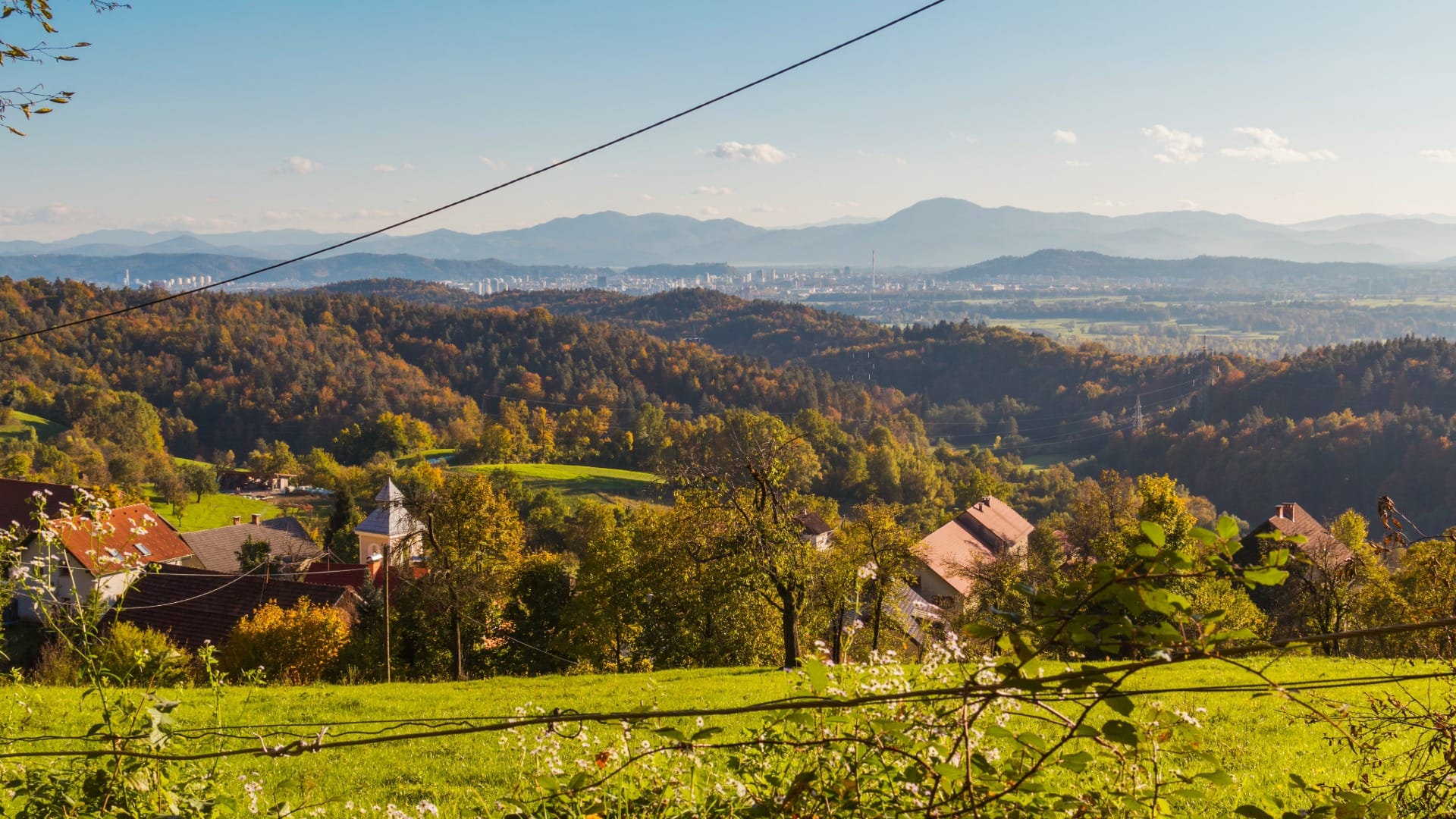
Rašica is a low, isolated hill on the northern edge of the Ljubljana basin — it doesn’t connect to a bigger range, which is exactly why the view from the top is so open in every direction. The loop goes up one way and down another, so you’re never retracing your own steps.
If you want something with more altitude and a proper mountain hut at the end, Mount Krim from Iška vas is the harder option in the same region. Rašica is the one to pick when the group includes small kids or anyone who just wants an easy afternoon out.
Route in detail
1) Rašica village and the climb past Bela peč
Park along the road on the approach to Rašica village and start on a gravel track that soon narrows into forest. The path passes Bela peč, a pale limestone outcrop that gives the first sense you’re gaining real height, then zigzags through steeper, rockier ground before easing off again near the top.
2) Dom na Rašici and the lookout tower
The mountain hut sits just below the summit, and a proper stone lookout tower stands right at it — worth the extra few steps up. On a clear day you get the Kamnik-Savinja Alps to the north, the Sava plain below, and the hills of Posavje rolling off to the east. It’s a small tower, but it earns its view.
There’s a shortcut here if you’re short on time or don’t need the full loop: a steep path drops straight down from Dom na Rašici to Rašica village, skipping the longer Dobeno leg entirely. It’s noticeably steeper underfoot than either of the main paths — fine for confident walkers, best avoided with young kids or after rain.
3) Down through Dobeno
The descent takes a different, gentler line through the hamlet of Dobeno — wider track, easier grade, genuinely suited to young children, which is why locals treat this direction as the “family side” of the loop. It’s also the longer of the two legs, so the climb feels steeper in memory than the way down does.
Travel insurance
Standard policies often exclude hiking and mountain activities — worth checking your cover before a day like this.
Map
The map shows the loop shape: a shorter, steeper climb from Rašica village to the tower, and a longer, gentler return through Dobeno back to the same starting point.
Best time
- Clear autumn or winter days: the best odds of an open, haze-free view from the tower.
- Spring: green meadows on the Dobeno side, but expect mud on the steeper climb after rain.
- Summer mornings: the forest section offers shade before the day heats up.
Safety & warnings
- Rocky zigzag section: short, but uneven underfoot — normal trail shoes are fine, just watch your footing.
- Tower platform: can be windy and slippery when wet or icy.
- Navigation: the loop is well marked, but the climb and descent use different paths — follow the markers rather than retracing your own route.
- Direct shortcut to the village: a steep path drops straight from Dom na Rašici back to Rašica — faster, but steeper and less suited to kids than the Dobeno route.
Logistics
By car
Rašica village is about 15 minutes from central Ljubljana — this is realistically the easiest of our nature-trail picks to reach without any real drive at all.
Public transport
Local buses run from Ljubljana toward Gameljne and the villages north of the city, though schedules are infrequent — check current times before relying on them, especially for a return trip later in the day.
Renting a car for trail days
Many of the trails on our portal are realistically done by car: early starts, flexible returns and last-mile forest or valley access are hard to match with buses.
Search rental cars — Slovenia & Ljubljana Airport
Author note: this is a short enough drive that even a half-day rental makes sense if you’re combining it with something else in the city.
How this trail fits into routes
Rašica works best as a quick escape from Ljubljana rather than a standalone day trip — pair it with time in the city itself.
- Short hikes near Ljubljana: Rašica belongs on the shortlist in Best Short Hikes Near Ljubljana (Under 2 Hours) — it’s one of the easiest entries on that list.
- Same region, more effort: if the group wants a longer day nearby, Polhograjska Grmada via Mačkov graben and Mount Krim from Iška vas are both within easy reach of the city.
Conclusion
Rašica isn’t going to be the highlight of anyone’s Slovenia trip, and it doesn’t need to be — it’s the loop you do on a spare afternoon, with kids in tow or without, when you want a real tower view for very little effort. Go on a clear day, and take the Dobeno side down.