
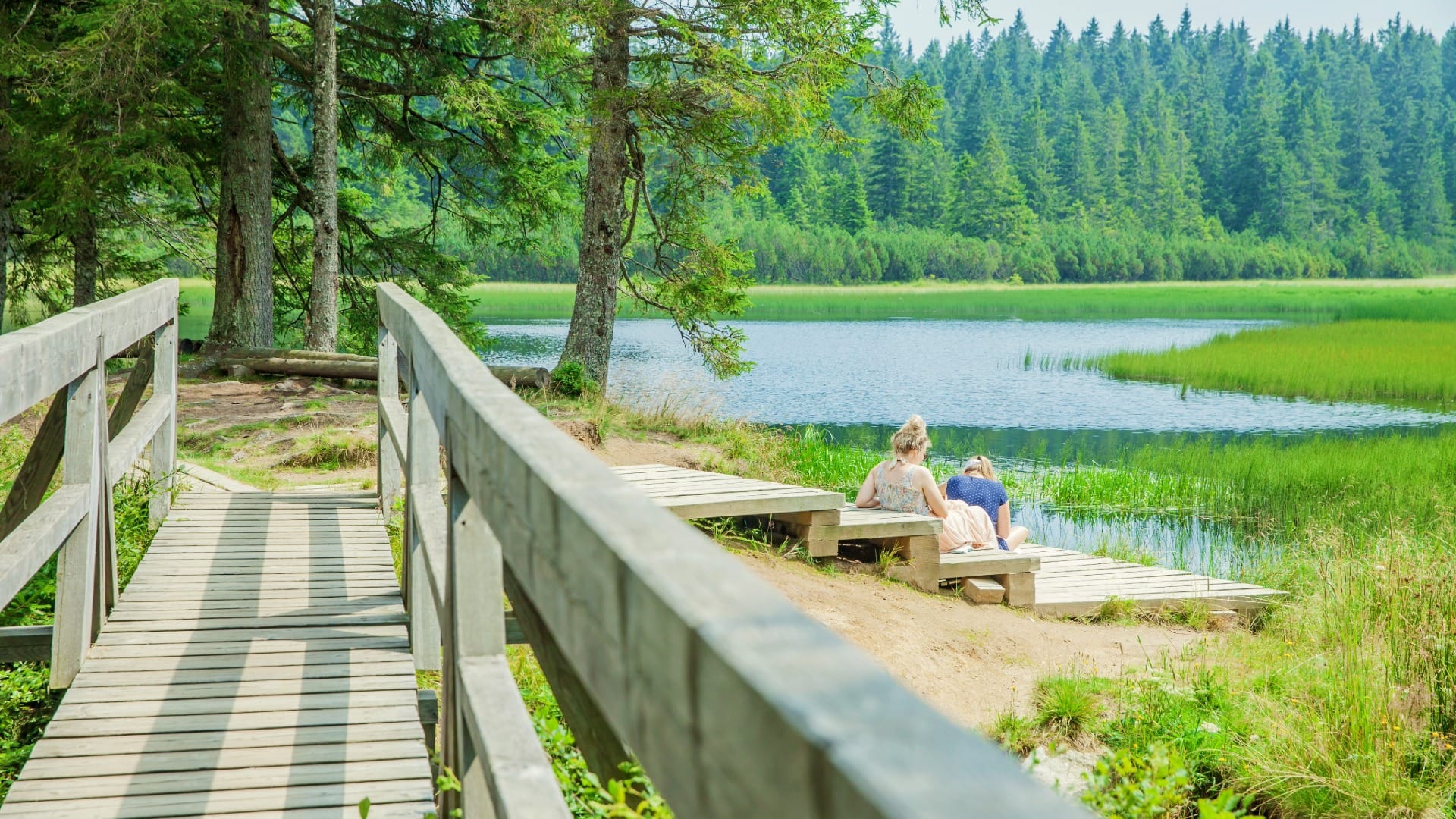
Črno jezero (Black Lake) Trail from Trije Kralji
East Slovenia
Where to base yourself
Search places to stay near here and book directly on Booking.com.
Find a place to stayČrno jezero (Black Lake) Trail from Trije Kralji
Quick Overview – Črno jezero (Black Lake) Trail
A short forest walk from the Trije Kralji recreation area that isn’t quite as flat as its “easy” rating implies: it climbs over a minor summit, Veliki vrh, before dropping down to Pohorje’s largest lake — officially nicknamed the region’s “black pearl” — and finishing at Osankarica.
Trade-off: from Trije Kralji this is barely an hour, easy in every sense. Don’t be fooled by the alternative Oplotnica approach on the same official trail map — it’s rated “easy” too, but it’s a real 954 m climb over 9.2 km. If we want the lake without the workout, Trije Kralji is the only sane choice.
- Type: easy forest lake walk
- Region: Pohorje (Slovenska Bistrica side)
- Works well with: Lovrenc Lakes in Pohorje, a Maribor day, or the Habakuk trail on the opposite side of the massif
 Trail stats
 Trail stats
- Distance: 3.98 km
- Elevation gain: 154 m
- Time: ~1 hour at an easy pace
- Difficulty: Easy (one gentle climb over Veliki vrh, no exposure)
Slovenia Trip Starter Kit
Plan Slovenia without the usual route mistakes — a free, practical starter guide sent straight to your inbox.
Get the free guide →What to expect
 What to expect
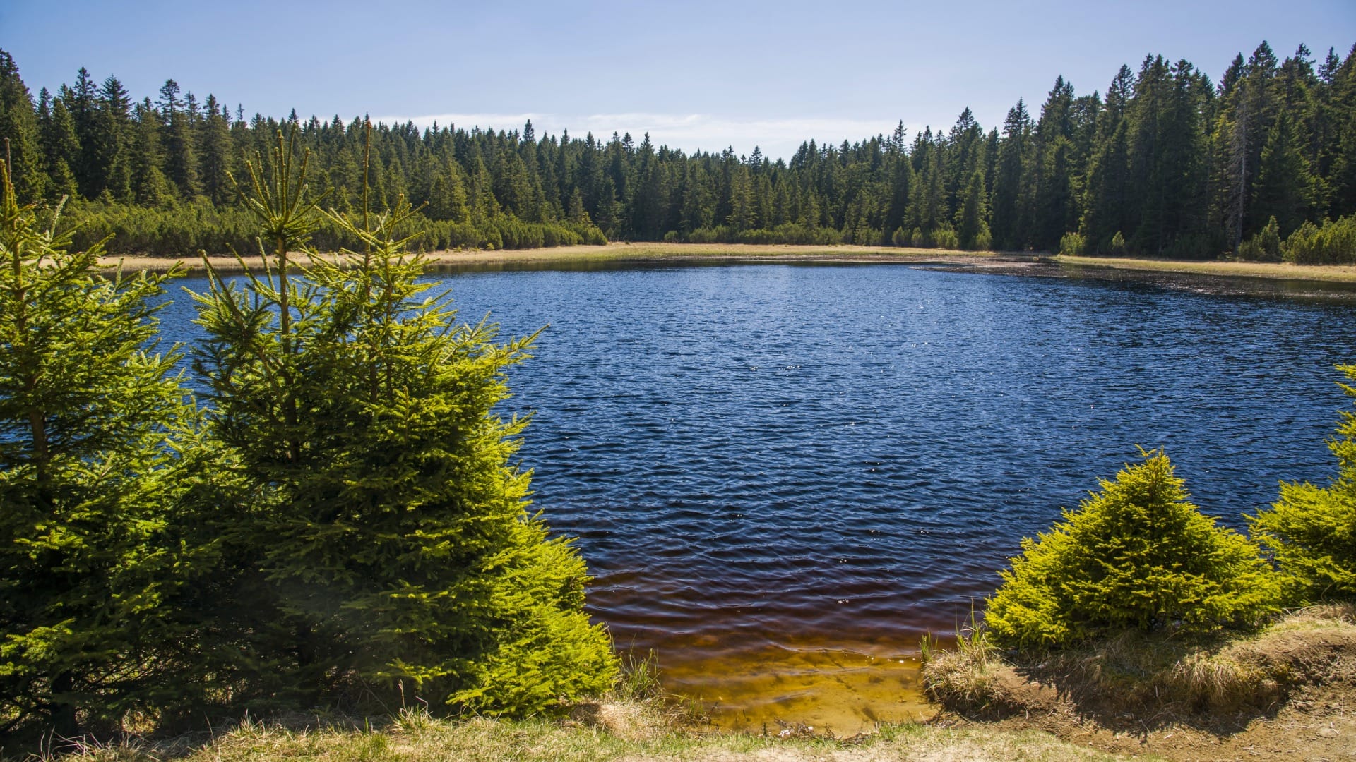
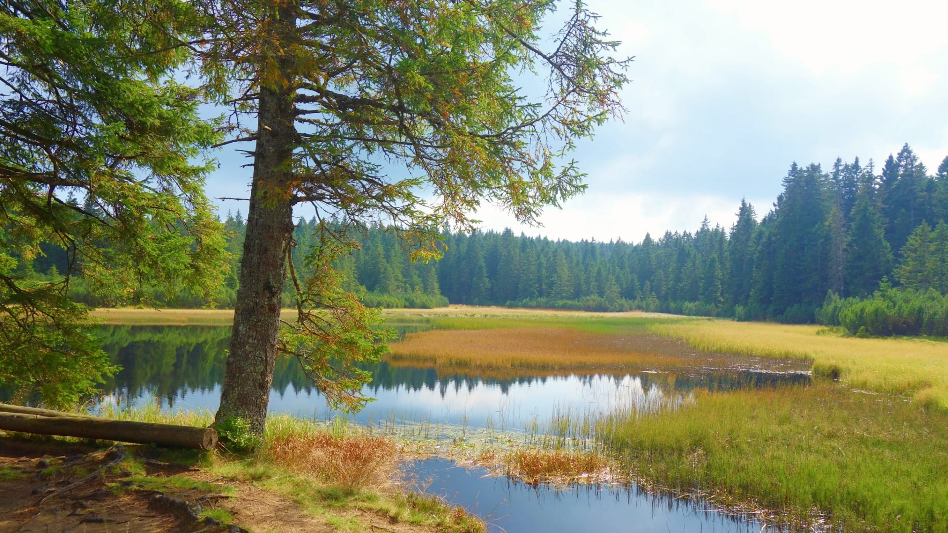
Črno jezero earns its “black pearl” nickname honestly: the water reads almost black, not from pollution but from a thick layer of organic sediment — decades of fallen needles, moss and leaf litter — that has settled on the lakebed. It’s Pohorje’s largest lake and a protected natural monument, ringed by spruce forest and genuine sphagnum peat moss, the kind of bog vegetation that’s genuinely uncommon this far south in Europe.
It isn’t fully natural either. The basin was deepened roughly 130 years ago under Count Windischgrätz, as a water reservoir to help float cut timber down from the Pohorje forests — a working detail that explains why the shoreline feels engineered in places even as the surrounding bog feels wild.
What our own track through it shows, and what the official “easy” label doesn’t quite prepare you for, is that this isn’t a flat there-and-back to the shore. It climbs about 100 m to a minor summit, Veliki vrh, within the first stretch, then drops back down to the lake before finishing at Osankarica. Still genuinely easy walking, just not a level stroll.
Route in detail
1) Trije Kralji recreation area
Start at Trije Kralji, a small ski-and-recreation hub on eastern Pohorje at around 1,181 m. It’s the most straightforward of the official approaches to the lake — Oplotnica, on the same trail map, is a much longer and harder climb from the opposite side of the massif.
2) The climb over Veliki vrh
The first kilometre and a bit is a steady forest climb to around 1,285 m, at a minor summit called Veliki vrh (“Great Peak” — modest by Alpine standards, but a real high point). There’s no marked viewpoint clearing here, just forest that thins slightly at the top; the climb itself, not a panorama, is the point.
3) Down to Črno jezero
 3) Down to Črno jezero
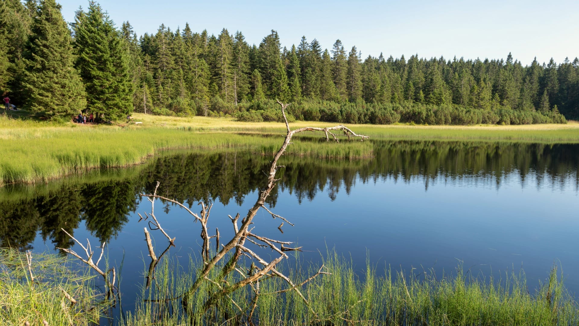
From Veliki vrh the path drops steadily back down, reaching the lake shore at around 1,200 m, roughly 3 km in. The lake opens up after the descent: dark, still water, reeds and peat moss at the edges. It’s a good slow-down stop rather than a photo-and-go one — the “black pearl” effect is more atmosphere than spectacle, and it rewards a few quiet minutes at the shore.
4) On to Osankarica and the Pohorje Battalion memorial
The trail doesn’t end at the lake — it continues about another kilometre to Osankarica (1,192 m), with one last small rise on the way. If you’d rather skip the Veliki vrh climb entirely, Osankarica is also its own separate trailhead, and from there the lake is a flat 970 m / about 25 minutes away — the easiest of all the approaches on the official map. Osankarica is also where a short extension leads to the memorial at the site where the Pohorje Battalion, a Slovenian WWII partisan unit, made its last stand in 1943; individual stone markers name where each fighter fell. It’s a sober, low-key site, worth the short detour if the history interests you.
Travel insurance
Standard policies often exclude hiking and mountain activities — worth checking your cover before a day like this.
Map
The map shows our actual recorded line from Trije Kralji over Veliki vrh to the lake and on to Osankarica, with the main stops marked.
Best time
- Summer and early autumn: the reliable window — the plateau is at altitude, so spring can still hold snow patches and mud.
- After rain: the peat sections get genuinely soft, not just damp — footwear with real grip matters more than the “easy” rating suggests.
- Midweek mornings: Trije Kralji is a low-key local spot, but it does get family day-trip traffic on summer weekends.
Safety & warnings
- Boggy shoreline: the peat moss edges look solid but hold water — stay on the marked track rather than walking out onto the moss itself, both for your boots and for the habitat.
- Don’t default to Oplotnica by mistake: if you’re picking a starting point off a map without checking distance, this is the one that turns an easy afternoon into a serious 954 m climb.
- Forest shade: the trail stays cool even in summer heat — a light layer is worth carrying.
Logistics
By car
Trije Kralji is reached by local roads from Slovenska Bistrica, on the quieter, eastern side of the Pohorje massif — this is not the touristy Mariborsko Pohorje side with the cable car. A car makes this genuinely easy; without one, plan on a longer day.
Public transport
There’s no direct public transport to Trije Kralji itself. This is a car- or organised-tour trail, not one to force onto a bus timetable.
Renting a car for trail days
Pohorje’s back side — Trije Kralji, Osankarica, Črno jezero — is realistically car territory. Public transport reaches Maribor easily; it doesn’t reach this part of the plateau.
Search rental cars — Slovenia & Ljubljana Airport
Author note: for a Pohorje day like this, a compact car with free cancellation is enough — you won’t need anything more rugged for the roads in.
How this trail fits into routes
Črno jezero is a good “other side of Pohorje” pairing for anyone who’s already done the Mariborsko Pohorje / Habakuk side of the massif — same mountain, a completely different, quieter mood.
- Same massif, different lakes: pair it with Lovrenc Lakes in Pohorje if bog/peat scenery is what you’re after — the two are geologically related but visually distinct.
- Maribor day trip: combine with a visit to Maribor for a half-day-nature, half-day-city rhythm — Slovenska Bistrica and the eastern Pohorje approaches sit about 30–40 minutes from the city.
- Wider region: if this is your first stop in East Slovenia, it pairs naturally with a look at the region overview before deciding what else to add to the trip.
Conclusion
Črno jezero rewards the low-effort approach: from Trije Kralji it’s under an hour to a genuinely atmospheric, dark-watered forest lake with a real story behind both its colour and its name. Just don’t let a map talk you into starting from Oplotnica unless you actually want the climb.